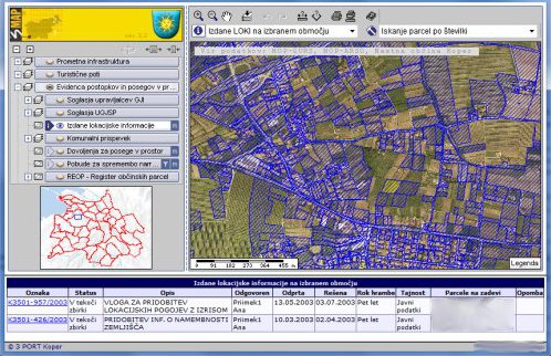
Issued location information
The Issued location information graphic layer shows the areas of plots (one or more) for which applications were submitted to the municipality to obtain the following:
- Certificate on the intended land use;
- Location information for the construction of buildings or performance of other works on lands or buildings; and
- Certificate on the intended land use with conditions of land allotment on building land.
Areas and plots are included in the space based on the time of application creation, consequently the issued location information can be monitored even through a determined period of time.
Display of the “Issued location information” graphic layer in the 3MAP viewer