Changes in land
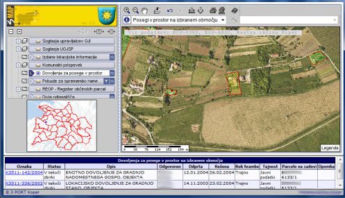
The Land use permit graphic layer shows the areas of plots (one or more) for which applications were submitted to the municipality to obtain:
- a permit for notified work,
- a planning permission,
- a building permit,
- a use permit; and
- a single permit for building.
It is a powerful tool for officials who deal with issuing information and permits to change or use land. In each selected area the 3MAP GIS viewer enables the view of different attribute data.
Display of the “Land use permit graphic layer” graphic layer in the 3MAP viewer